GREATERCIRCLE
Visit GREATERCIRCLEWhile standard flight maps draw straight lines from point A to point B, this tool calculates the true great-circle distance between any two points, factoring in political geography and user preference. Simply place your points, pick the regions or airspace to avoid, and watch the program plot out the optimal route.
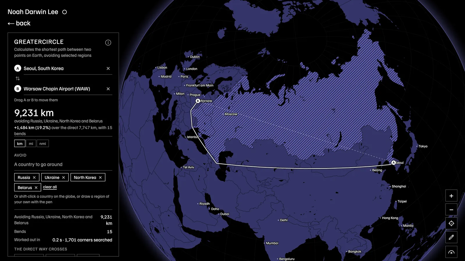
Seoul to Warsaw, around Russia, Ukraine, North Korea, and Belarus
Technical details
The route improves on great circle distance pathfinding on a sphere by calculating a chain of great-circle arcs bending only at the avoided regions' convex corners, found by an A* algorithm over their tangent visibility graph, in three-dimensional unit vectors.
Borders from Natural Earth; places from GeoNames and OurAirports, with Photon for the long tail. Labeled cities come from a modified GaWC index.
- Exact shortest paths
- 241 countries
- 14,500 places
- Web Worker
Inspiration
I was flying from South Korea to Poland and not long after takeoff, I booted up the seat-back flight map to see that our plane was projected to chart a straight line through four countries with closed off airspaces. As a nervous flier, knowing the accurate flight path would have put me more at ease.
Who it’s for
Flyers
- Checking whether a route really goes around a conflict zone before booking.
- Finding out why a flight took 2 hours longer than the map suggested.
- Comparing two itineraries to see which one actually flies a shorter path.
- Following along on a flight when the seat-back map is broken or out of date.
Aviation enthusiasts
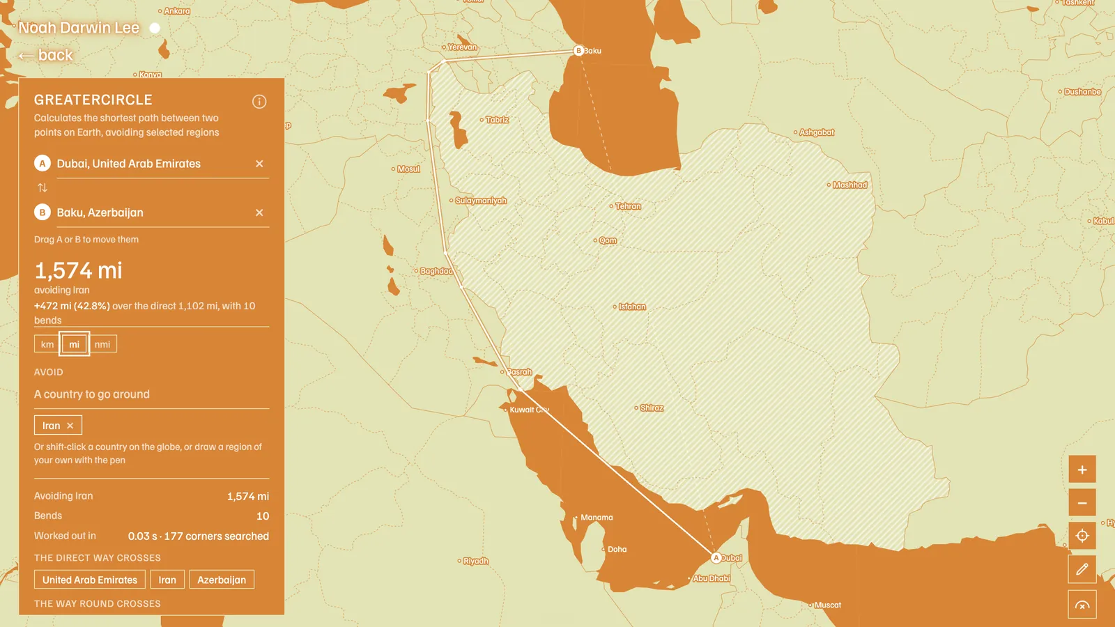
- Recreating real reroutes, such as Europe to Asia since Russian airspace closed, or the Gulf around Iran.
- Planning hypothetical routes for flight simulators like MSFS or X-Plane.
- Seeing why polar routes exist, by drawing Asia to North America the short way.
Teaching and journalism
- Showing in geography class why the shortest line on a globe looks curved on a flat map.
- Showing how airspace closures add distance, fuel, and emissions, for news graphics.
- Explaining how sanctions and geopolitics change a flight.
- Calculating extra distance in km, mi, or nmi for pieces on aviation emissions.
Professional and adjacent
- Students in aviation and dispatch learning great-circle navigation.
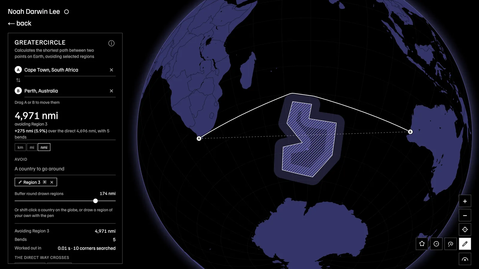
- Sailing routes around storm regions or restricted waters, using the drawn-region tool.
- Shipping and logistics planners avoiding chokepoints.
- Drone or balloon hobbyists avoiding restricted zones.
- Climate researchers estimating the extra CO₂ from detours.